
Catalogue of maps and plans

ORIGINAL MAP DATABASE OF THE IFEA:

List of workshop maps and plans (currently unavailable due to revision)

List of CH.E. insurance plans GOAD (Istanbul and Izmir)

List of insurance plans by J. Pervititch (Istanbul)
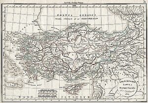
 

Collection of ancient maps and plans

  • A valuable collection of antique maps (19th and early 20th centuries) in Ottoman script of the Ottoman Empire and Turkey, 19th and early 20th century Austrian maps, primarily of the Balkans, at scales of 1:300,000 and 1:200,000—maps by the German geographers H. Heinrich and Richard Kiepert (late 19th – early 20th century):
    • Maps of “Imperial Rumelia” at 1:210,000,
    • Maps of Istanbul and its surroundings “Ottoman edition” at 1:25,000 and 1:50,000,
    • Maps of Turkey “Ottoman edition” at 1:100,000, 1:200,000 and 1/400,000
    • Other miscellaneous old maps
  • Specialkarte vom Westlichen Kleinasien – Map of the western part of Asia Minor, 1/250,000, atlas including 1 synoptic map of the administrative division of the provinces of the Ottoman Empire and plates, Heinrich Kiepert (1892)
  • Karte von Kleinasien, 1/400,000 (set of 2 boxes of 12 plates each), Richard Kiepert (1902-1906)
  • New general map of the Asian provinces of the Ottoman Empire (without Arabia), 1/1,500,000, drawn by Henri Kiepert, 1884
  • Karte von Armenia, Kurdistan und Azerbeidschan, Heinrich Kiepert, 1/1,000,000, 1852-1855
  • Insurance plans of Istanbul and Smyrna by Goad, 1904-1906, scales 1:600, 1:3,600
  • The insurance plans of Istanbul by Pervitich, 1922-1945 (a large portion of the plates), scales 1:250, 1:375, 1:500, 1:600, 1:1,000, 1:2,000, 1:2,400, 1:4,000


  •  
  •  


Series of topographic and geological maps

  • Topographic coverage of Turkey: 2 series of geological maps of Turkey at 1:100,000 and 1:500,000, and miscellaneous geological maps:
    • 1:200,000 (1940s-1950s) [series of 123 maps],
    • 1:500,000 (1970s),
    • 1:800,000 (1930s) complete series,
    • 1:1,000,000 (1970s) complete series, as well as numerous maps of Istanbul’s land division at various scales (often poor-quality prints).

Since 2004, the IFEA’s cartography workshop has been developing its catalog of maps and plans in digital format through exchanges with other institutions and digitization campaigns (scanning) of library materials (travelers’ books and others) and paper maps from the IFEA map library.

A database containing this digitized data is currently being developed and will be accessible via the IFEA website for secure public consultation (10,000 documents). We are seeking partners or sponsors for this project.


Maps and plans available for consultation on site

  • All cadastral maps of Greater Istanbul in DXF format at a scale of 1:1000, dating from 2002 and 2006.
  • Land use and subdivision plan of the Istanbul Metropolitan Municipality, created using automatic photo interpretation based on aerial photographs from 2000, in ArcGIS format. GIS data from 2000, 2006, and 2010; orthophotos from 1966, 1982, and 2010 for the Istanbul district.

Thematic maps and plans created by the workshop using CAD or GIS are also available. A large portion of our maps and plans are now available in digital format (70% of our catalog).